Mapping Hydro Features in the Land of 10,000 Lakes Using Lidar
Posted on
Download a PDF version of this writeup here.
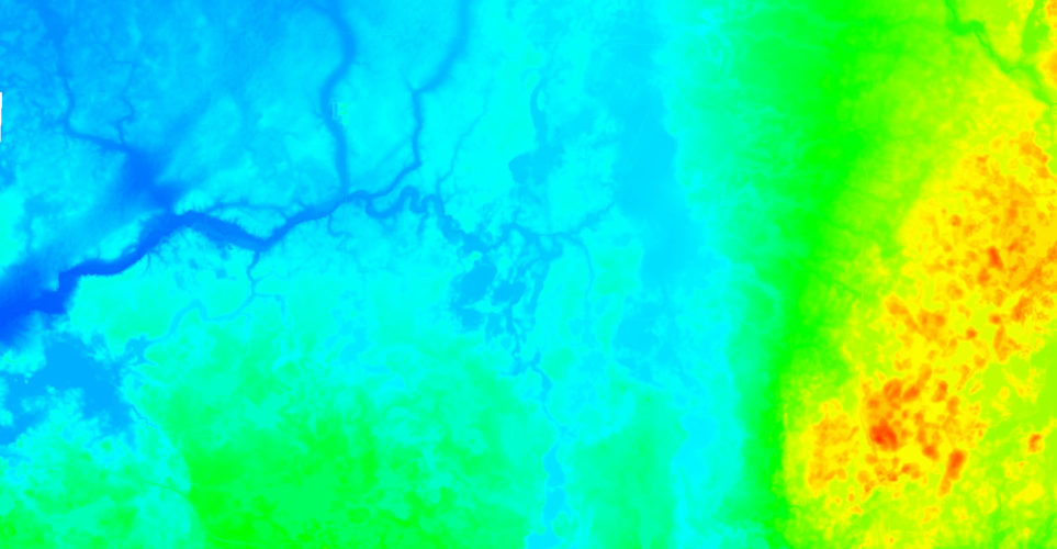
Minnesota is one of the most challenging places to map hydrological features. In addition to being home to over 10,000 lakes, Minnesota has a very short aerial mapping season—there is often snow on the ground into early spring, leaving a very small snow-free, leaf-off window.
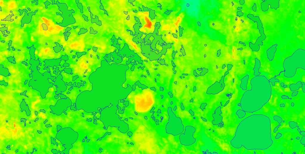
In 2022, the US Geological Survey (USGS) required lidar data and derivative products over a 1,500-square-mile area in central Minnesota. Through its Geospatial Products and Services Contract (GPSC4) the Merrick-Surdex Joint Venture was awarded a task order to provide QL1 lidar and hydro-flattening breaklines over this area, and the challenge was clear.
Careful flight planning and powerful technology were critical to providing the requested data in this hydrologically complex region with dense vegetation. The JV used powerful Galaxy T2000 lidar sensors and planned flight lines for capture of a higher point density than was required—while QL1 lidar requires only 8 ppsm, the flight plan accounted for 10ppsm, ensuring sufficient penetration to the ground surface through the dense vegetation conditions.
Through these flight planning tactics and constant monitoring of local weather and ground conditions, the JV was able to successfully acquire the required data within the limited snow-free, leaf-off window. When production was complete, the USGS was provided with classified point cloud LAS files, bare-earth DEM data, and hydro-flattening breaklines—including over 2,000 lakes and ponds!
Contact
Brett Thomassie, VP Business Development
(985) 718-7155 | brett.thomassie@surdex.com