Surdex Product Deliverables
Posted on
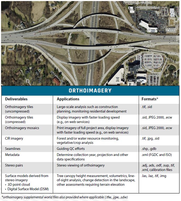
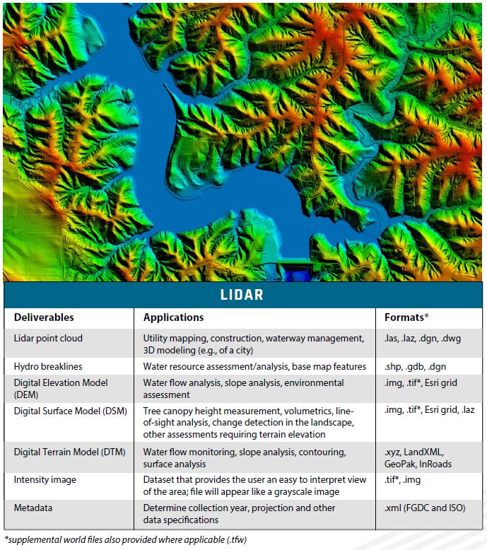
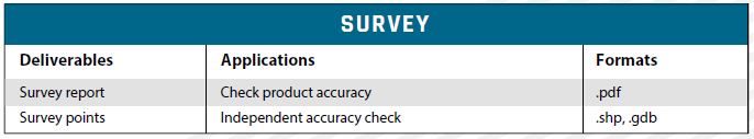
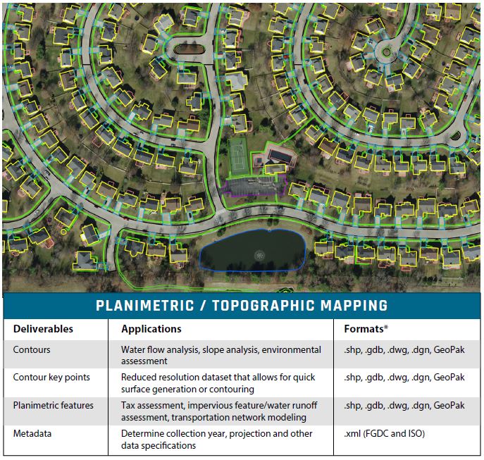
One critical part of geospatial project design is ensuring the plan includes all required deliverable file formats. The following tables list the product deliverables that Surdex can provide, including example applications and file formats. We have only listed the most common formats – we can produce hundreds of different formats and will provide the data you need, in the formats you need!
A PDF handout of this information can be downloaded here.