Supporting ALTA Surveys for Solar Farms with Aerial Mapping Data
Posted on
Download a PDF version of this writeup here.
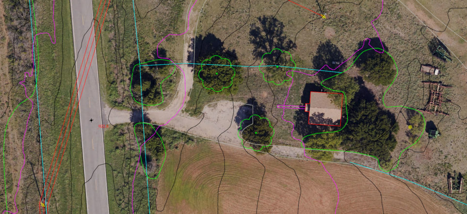
American Land Title Association (ALTA) surveys are a critical step in major construction projects and the sale of land. When solar farms are involved, precise, accurate geospatial data representing the earth’s surface is a particularly valuable tool in the ALTA process. Aerial imagery and lidar data enable collection of planimetric data representing ground features, such as buildings and powerlines, and topographic data depicting the earth’s elevation.
Surdex has completed several mapping projects for solar farm ALTA surveys, totaling over 350 square miles in 6 different states. These projects typically include high-resolution aerial imagery and dense lidar acquisition for the production of 5cm resolution digital orthoimagery, Digital Elevation Models (DEMs), planimetric data and topographic contours. Our cost effective dual-sensor mount enables simultaneous capture of the imagery and lidar data, resulting in efficient, timely acquisition. This method of acquisition also ensures that features in both datasets will not vary due to temporal differences that may occur with a split acquisition.
These rich geospatial datasets enable more efficient and precise completion of ALTA surveys, ensuring solar farm projects progress smoothly. Contact us to find out more or to initiate a project.
Contact
Tim Bohn, CP, PMP, VP Business Development
Office 636-368-4456 | Mobile 314-952-2617