Tornado Damage in Andover, Kansas, Captured in Aerial Imagery
Posted on
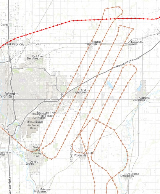
On Friday, April 29, an F3 tornado hit Andover, Kansas. The tornado damaged 1,000 properties in the area; no deaths were reported. The Kansas Data Access & Support Center (DASC), the Kansas 911 Coordinating Council and local affected counties determined there is a need for imagery of the damaged area, and they contacted Surdex Corporation on Saturday (April 30) to set up an aerial imagery acquisition project. A plan was created to enable acquisition as soon as the sun angle and atmospheric conditions allowed the next day.
Surdex deployed a Cessna 206 equipped with a DMC frame camera to acquire imagery of the impacted area on Sunday, May 1. Imagery was acquired at 1-foot resolution over a 45-square-mile area. As soon as the imagery is processed, it will be posted to a web service and will be available May 5th or 6th.
Surdex has a contract with the Kansas Department of Administration that includes acquisition of statewide imagery (in 2021-2022) as well as acquisition of additional imagery over areas damaged by natural disasters such as tornadoes or flooding (at no additional cost). Through a prior iteration of the contract, in 2019 Surdex acquired 1-foot resolution imagery of tornado damage in Douglas and Leavenworth counties. The company has completed several rapid response disaster mapping projects for flooding and tornadoes in various states over the past five years.
For more information, contact Jack King, Business Development Representative at Surdex or Kenneth Nelson, Kansas Geographic Information Officer and Director at the DASC.
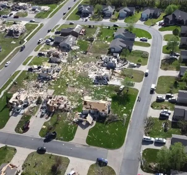
(Feature image above: A residential area in Andover, KS, where the tornado touched down on April 29, 2022.)
Kenneth A. Nelson
Kansas Geographic Information Officer
Director, Data Access & Support Center (DASC)
Kansas Geological Survey
University of Kansas
1930 Constant Avenue
Lawrence, KS 66047
785-864-2164
nelson@ku.edu
Jack King
Business Development
Surdex Corporation
Mobile: (601) 405-4070
Office: (636) 368-4420
jack.king@surdex.com