Post-Tornado Mapping for Missouri State Capital Area
Posted on
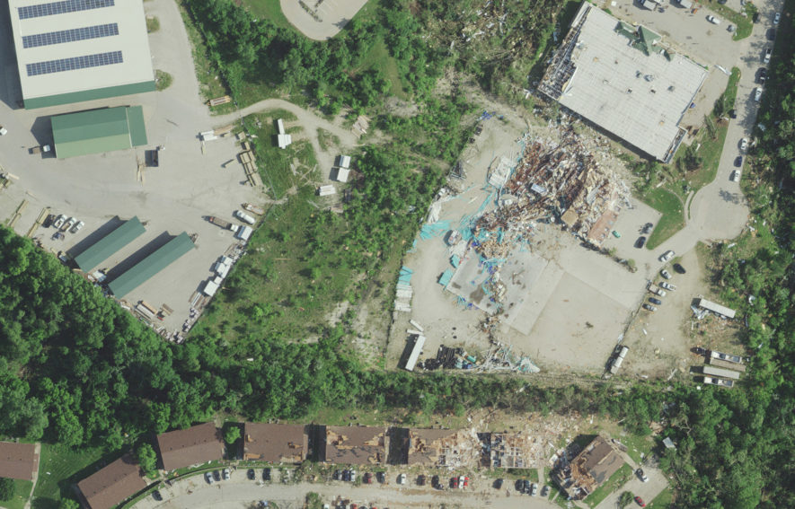
On May 23, a tornado hit Jefferson City, Missouri, the state capital. Multiple local and state entities collaborated in planning orthoimagery and LiDAR acquisition of the affected area through Surdex. We deployed two aircraft over the 56-square-mile project area in order to collect 6” GSD orthoimagery and QL2 LiDAR data simultaneously. To deliver the data as quickly as possible, the data was minimally processed, and within 24 hours it was posted to three different web services in order to provide immediate access to state and local officials and enable redundancy and a higher user capacity. Our imagery and LiDAR data were extremely useful for emergency response and recovery, as well as assessment of damage to buildings.
Check out our imagery and LiDAR data of the tornado damage:
https://iserver6.surdex.net/SC_P2900509S0/SurcheckViewer.asp (imagery)
https://iserver6.surdex.net/SC_P2900509S1/SurcheckViewer.asp (LiDAR)
*NOTE: disaster mapping imagery is flown under relaxed acquisition conditions and therefore does not meet standard orthoimagery quality specifications