Surdex, a Bowman company
Surdex is now a
Bowman company
Surdex is now a bowman company
As of April 4, 2024, Surdex has officially joined Bowman. Bowman is a leading national professional services firm offering multi-disciplinary engineering, planning, surveying, geomatics, construction management, environmental consulting, landscape architecture, and right-of-way acquisition.
This change provides a strong foundation for our firms to merge our comprehensive skillsets while offering the same level of commitment to deliver outstanding project results, build long-lasting relationships and leverage the growth of our organization to serve the ever-changing needs of our clients.
—
Your project goals are crucial

And we deliver. We track our performance to know that we’re meeting our clients’ needs:
- First-Time Acceptance 98%
- On-Time Delivery 98%
- Client Satisfaction 99%
We realize that your digital orthoimagery and mapping project is your number one priority. It has to be right, it has to be accurate, and the data must be premium quality. It’s our job to deliver exactly what you need in the timeframe you need it – so that you can do your job.
Serving clients since 1954, Surdex offers high-resolution orthoimagery, lidar and digital mapping services to public sector and private industries. Whether it’s developing intelligent mapping or delivering data for mapping software, our full-service firm offers the highest-quality aerial imagery, data and mapping products, technical resources and support for all your geospatial goals.
Technology
Digital Orthoimagery
Digital orthoimagery is seamless, extremely-accurate imagery of the Earth’s surface used for GIS, intelligent mapping and geospatial analysis.
Sensors
Surdex primarily operates two types of image sensors, the Lecia ADS100 Airborne Digital Sensor (five) and the Leica DMC-1 Digital Frame Camera (three).
The ADS100 is one of the most advanced systems on the market. As a pushbroom sensor, the ADS100 acquires a wide swath of imagery in a continuous strip with each flight line, thereby reducing acquisition time. Surdex teams have logged over 4 million square miles of coverage with the ADS100 as our primary sensor since late 2013.
The DMC-1 is a large-format digital camera system comprised of eight individual cameras. These systems are tried-and-true workhorses that are ideal for mid-size and smaller projects and for mapping projects.
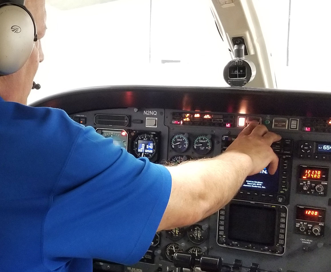
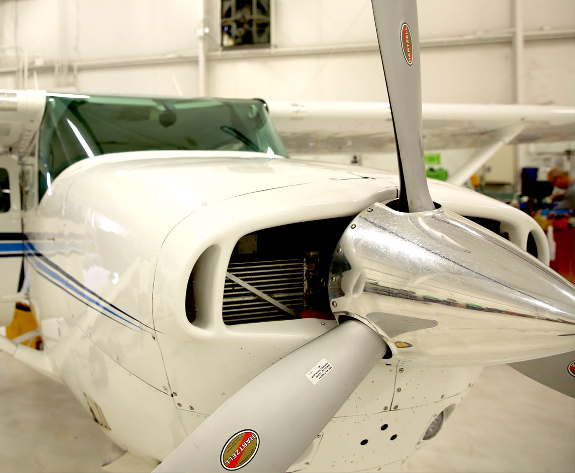
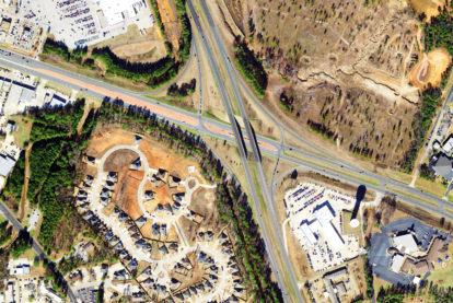
Aerial Acquisition
Aerial acquisition projects often have limited windows of opportunity for optimal image collection. Owning our own fleet of aircraft provides our clients with many benefits. First, the fleet is comprised of diverse aircraft with the capability to fly lower and slower, or fast and higher, depending on the service requested. The size of our fleet also ensures we have the ability to rotate aircraft in and out, to mobilize quickly, and to have contingency aircraft available to meet any unforeseen conditions. Surdex has the resources and expertise to acquire data and imagery within your specified time frame.
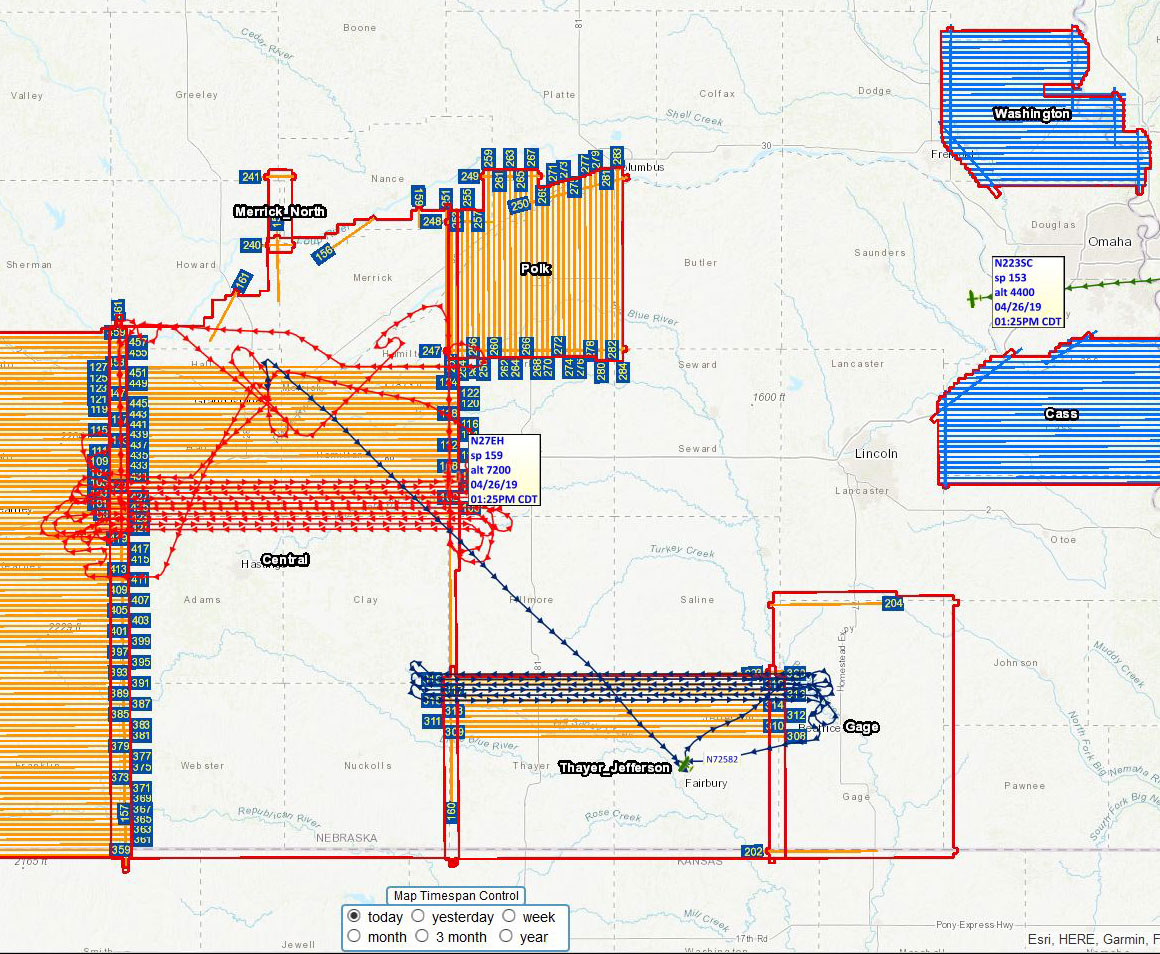
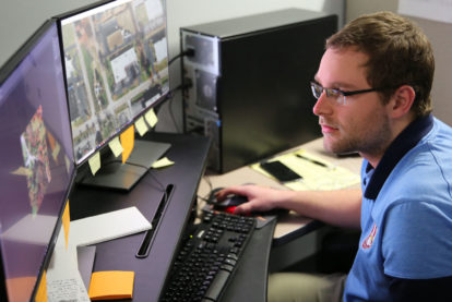
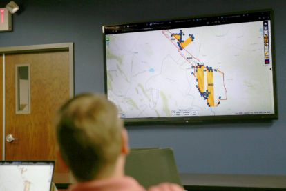
Flight Tracker
Surdex provides clients with live reporting of acquisition progress through our online Flight Tracker tool. The system continuously reports whether the aircraft assigned to your project are over the project area, headed to the site, returning from the site, acquiring airborne data or stationed at a local airport.
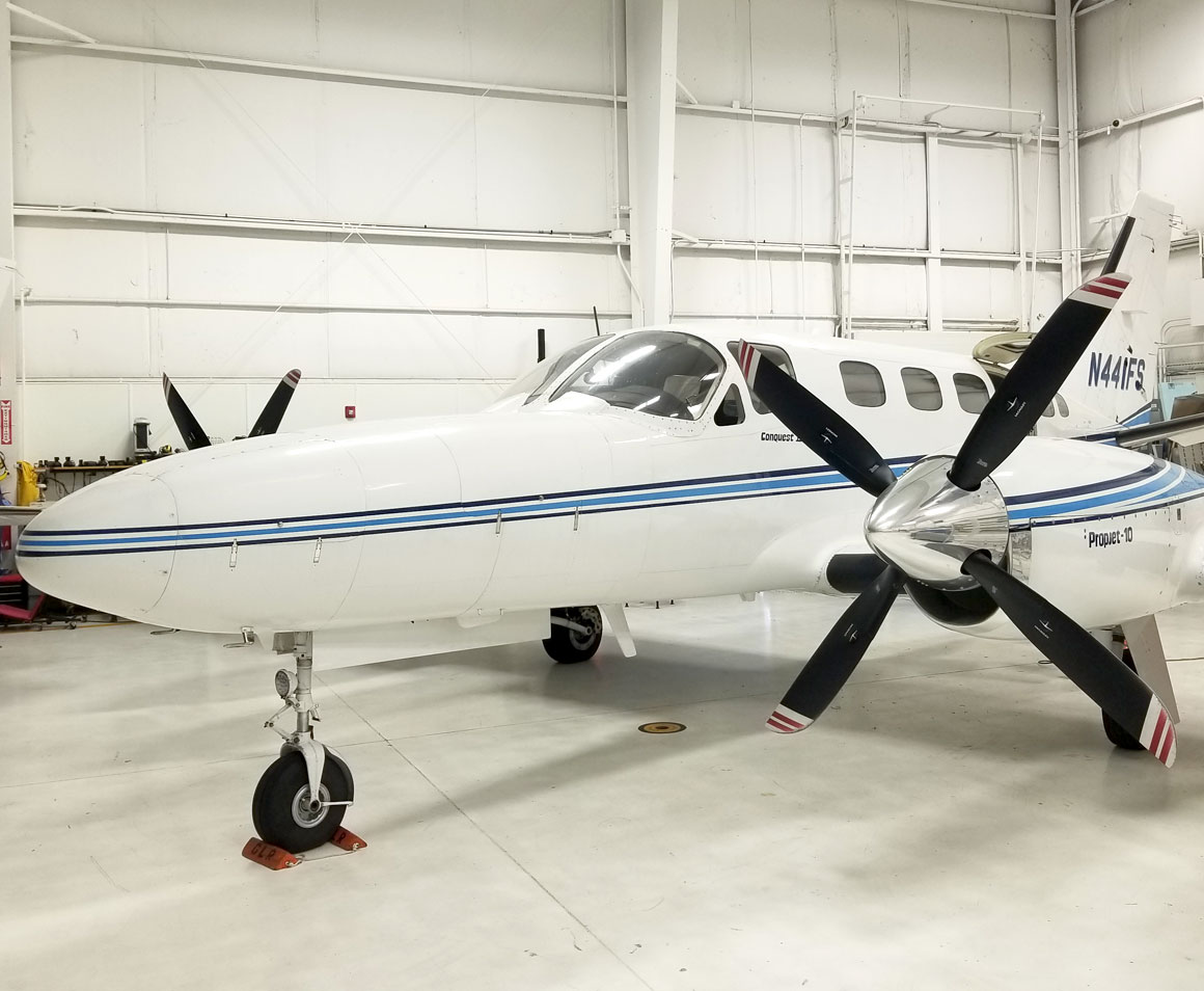
Fleet
Surdex currently owns and operates ten aircraft for imagery and LiDAR acquisition out of our flight center at the Spirit of St. Louis Airport. Employing full-time A&P (Airframe and Powerplant) personnel to perform FAA-certified inspection, maintenance, and repair, omits costly and time-consuming reliance on third-parties.
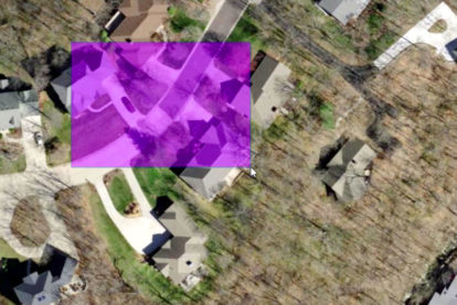
LiDAR
Surdex acquires LiDAR data using one of the most advanced LiDAR sensors in the industry, the Teledyne Optech Galaxy. Through the aerial acquisition and quality control process, Surdex produces incredibly accurate LiDAR data for all geospatial project needs.Surdex is a major provider of LiDAR data, and the Merrick-Surdex Joint Venture is an approved USGS GPSC provider.
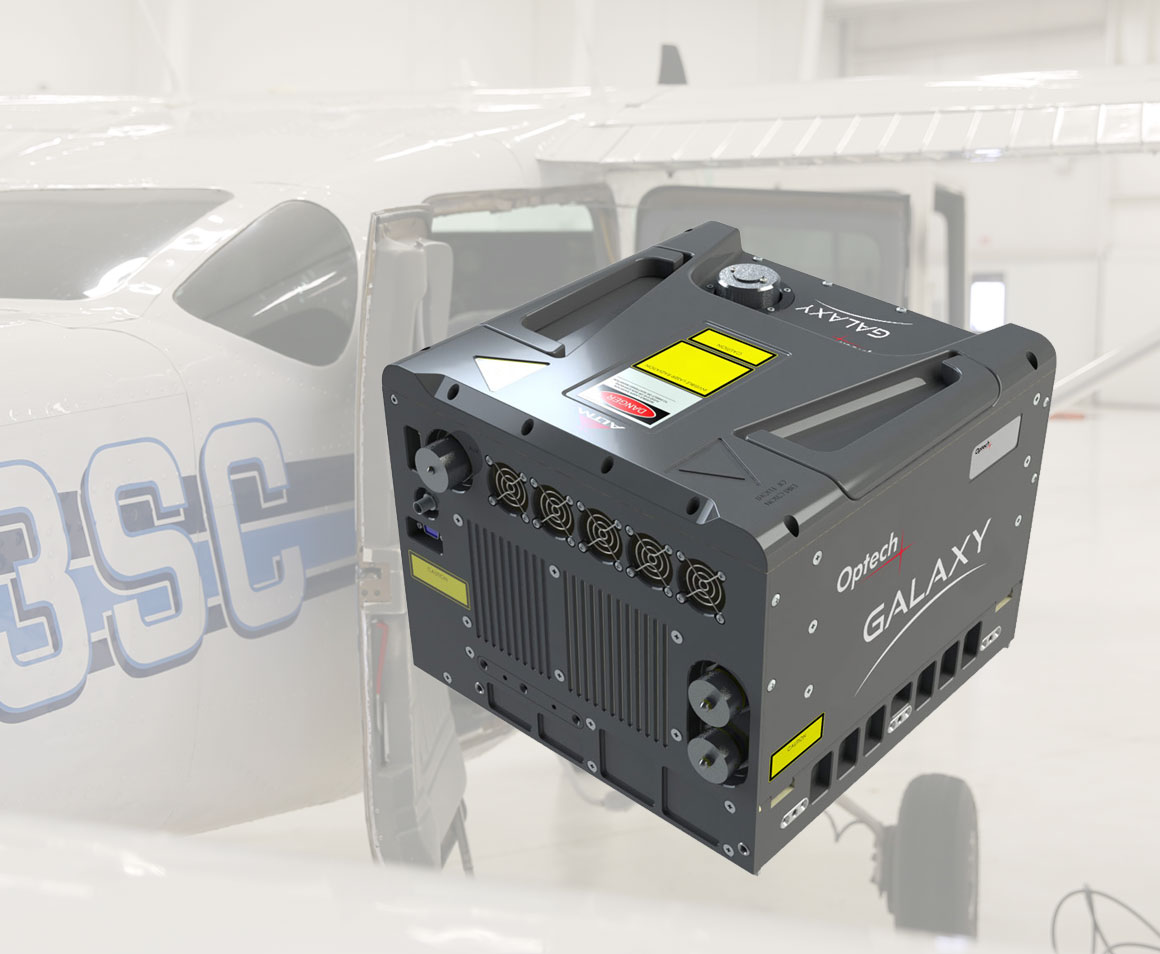
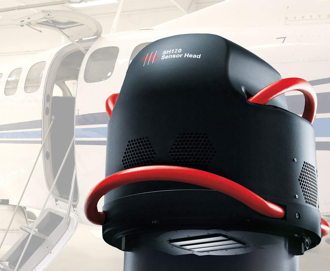
Sensor
The Teledyne Optech Galaxy LiDAR sensor uses innovative LiDAR technology enhancements and incorporated flight and calibration software that significantly increases sensor performance, collection efficiency, improved data quality and simplifies the collection process.
Acquisition
With several single-engine aircraft suitable and available for LiDAR collection, and several twin-engine aircraft in reserve, Surdex has the capacity and flexibility to overcome a variety of unforeseen challenges during acquisition. This flexibility ensures our clients that we are taking advantage of every window of opportunity and that their projects are on schedule.
Quality Control
Surdex incorporates QC measures to ensure the GPS data is correct and will produce the most accurate point cloud possible. During QC, data is inspected for coverage, continuity and accuracy. Inspection will verify that proper planning, acquisition and sensor function have produced data that meets clients’ needs.
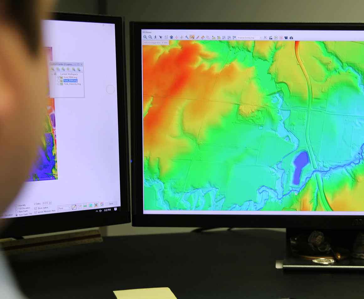
Digital Mapping
Digital mapping contains embedded intelligent data that can be visually interpreted by the user. For example, civil engineers and city planners can use data from topographic and planimetric mapping to evaluate terrain and contours of an area, as well as, natural and man-made features of a surface. Our rigorous QC processes ensure clients’ mapping meets the desired specifications.
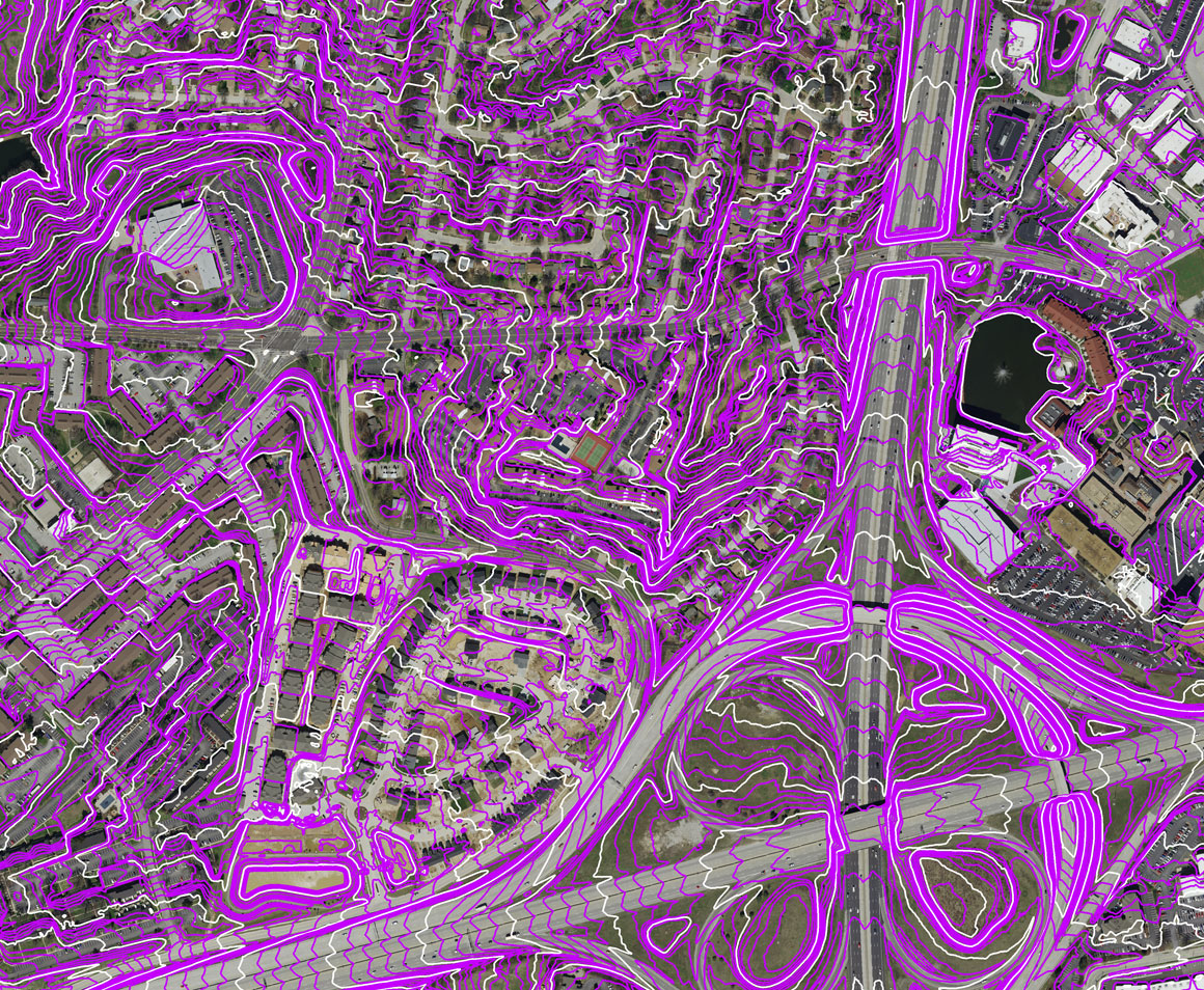
Topographic Mapping
Topographic maps depict the three-dimensional shape of the earth’s surface with contour lines at specific intervals to depict the shape and elevation (or relief) of terrain. Topographic maps often portray both natural and man-made features.
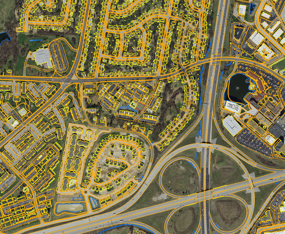
Planimetric Mapping
Planimetric map can include both man-made (cultural) and natural features. These features are represented three-dimensionally as lines (vectors) and points. These features are extracted from aerial photography using modern technology; anything visible in the imagery can be digitized.
Applications and Industries
Surdex has supported clients from the public sector (including federal, state, county and municipal entities) and private sector on small- to large-scale projects. To provide our clients with custom imagery and mapping products, we own a fleet of specialized acquisition aircraft equipped with large- and medium-format digital sensors (including the Leica ADS100 Airborne Digital Sensors, the Leica DMC-1 Digital Frame Camera, and Optech Galaxy Prime lidar sensors). Our investment in state-of-the-art processing equipment, a highly-skilled workforce and a proven methodology for quality control ensures our clients’ spatial data will meet their specifications and be on schedule.
Our work has detailed several industries and applications, for example; supplying engineering and architectural firms with mapping data for development projects, producing pipeline mapping lidar data for the oil and gas industry, delivering imagery for energy and utilities companies to use for swag analysis and vegetation identification, collecting digital mapping data for roadway engineers to plan transportation and infrastructure projects, and processing geospatial data for federal agencies and local governments.
Our Process
Over the years, Surdex has awarded some of the largest digital orthophotography projects of their kind in the nation. We are among the largest digital orthoimagery firms in the country and are widely acknowledged as one of the country’s most advanced, quality-driven mapping firms.
Our rigorous internal QA/QC measures ensure that our clients are receiving premium quality products. Our clients spend less time reviewing and managing corrections, which in turn means their products are put into operation quicker. Our data is accepted by clients on the first delivery 98% of the time.
Surdex has instituted ISO processes to continuously improve our quality control and efficiencies. Thorough training and adherence to processes results in consistent, repeated quality of product. Accuracy and quality are thoroughly reviewed at each stage of production and before delivery to our clients. Our deliverables have a 99% first-time client acceptance.
A successful project management strategy not only keeps our clients’ projects on schedule, it also keeps them informed of progress on all activities. Our promise is to keep our clients informed of progress and milestone achievements as well as any irregularities – keeping them in the loop so they know their project is on schedule. That’s how we keep a 99% client satisfaction.