Minnesota and Wisconsin Forestry Fall CIR Imagery
Posted on
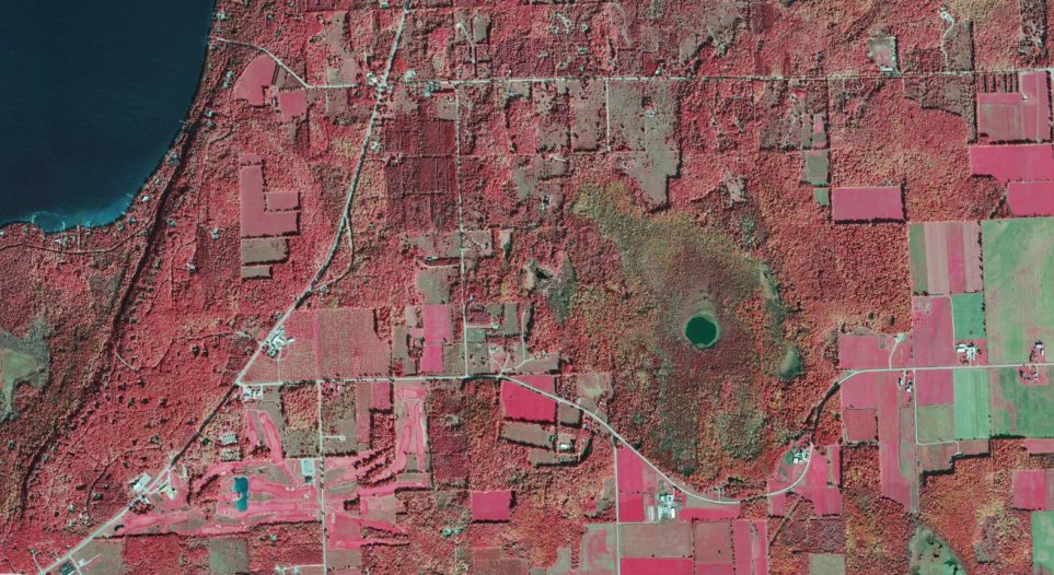
Within the past few years, Surdex has completed fall colors imagery projects for two state forestry agencies—one in Wisconsin and one in Minnesota. For these agencies, aerial imagery serves as a tool for monitoring the extent, species makeup and condition of forests. Color infrared (CIR) imagery acquired in the fall is particularly useful because it allows forestry professionals to more accurately determine the species of the trees. The imagery must be acquired within a one- to two-week window during which the leaves of deciduous trees begin to turn various shades of yellow, orange, red and brown prior to falling off. Completing the acquisition in this window – which can be further restricted by cloud cover – is challenging, as these project areas often encompass multiple counties. These projects are completed with our DMC frame sensors because they are better suited to producing the stereo imagery requested by these clients.